the diagram shows circles drawn by geologists trying to determine the location of an earthquakes epicenter…
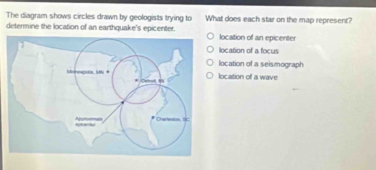
the diagram shows circles drawn by geologists trying to determine the location of an earthquakes epicenter. what does each star on the map represent? location of an epicenter location of a focus location of a seismograph location of a wave
Answer
Brief Explanations:
Geologists use circles drawn from seismograph - locations to find an earthquake's epicenter. The stars on the map are the locations from which the circles are drawn, which are the locations of seismographs.
Answer:
location of a seismograph